Skip to Content

Regions

Bangkok

Бангкок

BANGKOK HOTELS

BANGKOK TOURS


   Bangkok (Thai: กรุงเทพฯ Krung Thep) is the capital of Thailand and, with a population of over eleven million inhabitants, by far its largest city. Its high-rise buildings, heavy traffic congestion, intense heat and naughty nightlife do not immediately give you a warm welcome — but don't let your first impression mislead you. It is one of Asia's most cosmopolitan cities with magnificent temples and palaces, authentic canals, busy markets and a vibrant nightlife that has something for everyone. For years, it was only a small trading post at the banks of the Chao Phraya River, until King Rama I, the first monarch of the present Chakri dynasty, turned it into the capital of Siam in 1782, after the burning of Ayutthaya by Burmese invaders. Since then, Bangkok has turned into a national treasure house and functions as Thailand's spiritual, cultural, political, commercial, educational and diplomatic centre.

Just under 14 degrees north of the Equator, Bangkok is a tropical metropolis that is also one of the most traveller-friendly cities in Asia. A furious assault on the senses, visitors are immediately confronted by the heat, the pollution and the irrepressible smile that accompanies many Thais. Despite the sensationalised international news reports and first impressions, the city is surprisingly safe (except from some petty crimes) and more organised than it initially appears, and full of hidden gems waiting to be discovered. The high relative humidity and warm temperature favour the growth of tropical plants — you'll find exotic orchids and delicious fruit everywhere. Bougainvillea and frangipani bloom practically all over the city. Thai cuisine is justifiably famous, varied, and affordable. Bangkok for many represents the quintessential Asian capital. Saffron-robed monks, garish neon signs, graceful Thai architecture, spicy dishes, colourful markets, traffic jams and the tropical climate come together in a happy coincidence. It is difficult to leave with lukewarm impressions of the city.

BANGKOK (CENTER) MAP

  1. Amari Watergate Bangkok

  2. Baiyoke Sky

  3. Eastin Hotel Makkasan Bangkok

  4. Four Seasons Hotel Bangkok

  5. Ramada D’Ma Bangkok

  6. Siam Kempinski Bangkok

  7. The Twin Towers Hotel


Phuket, Khao Lak

PHUKET HOTELS

PHUKET TOURS


PHUKET

   Phuket nestles in balmy Andaman Sea waters on Thailand's Indian Ocean coastline 862 kilometres south of Bangkok. Phuket formerly derived its wealth from tin and rubber, and enjoyed a rich and colourful history. The island was on one of the major trading routes between India and China, and was frequently mentioned in foreign trader’s ship logs. In recent times, though, Phuket's top earner has been tourism, which has transformed the island into Thailand's wealthiest province. Expect prices to be a bit higher than on the mainland. The west coast of Phuket was hit severely by the Indian Ocean tsunami of December 2004, but almost no evidence of the damage now remains. Phuket enjoys great popularity as a travel destination. Most beaches are on the west coast, with Phuket Town to the south-east and the airport in the north. Phuket is hot and humid throughout the year. The hot season is generally considered to be from March to early May. During the summer monsoon season from May to October, mornings and afternoons are still sunny and clear, but it tends to rain in the evenings and water clarity goes down. Locals consider November to February the "cool" season, and the weather is quite tolerable, much more so than in the tourism centers around the Gulf coast. It's comparable to Florida's summer weather in temperature and intensity of rain storms: 25-33 deg C, flying clouds, short and thunderous rainfalls in the afternoons and evenings. Surfing is possible off the western beaches. Phuket is a melting pot of Buddhists, Thai-Chinese, Muslims and even sea gypsies. The majority of the population in the rural areas is Muslim. Outside of the provincial town, the rural folk speak with a thick Southern dialect which is difficult for even other Thais to understand. The provincial town’s economy having boomed over the past decade has led to a lot of the youngsters leading similar lives to those in Bangkok. Altogether, the lifestyle of the urban Thai-Chinese resembles that of Bangkokians.

KHAO LAK

   Khaolak is named after the national park (Khao Lak-Lam Ru). The park was declared a national park in August 1991. It occupies a vast area of 150² km and covers Amphoe Thai Muang, Amphoe Kapong, Amphoe Takua Pa and Amphoe Muang. Khao Lak is becoming increasingly popular, mainly with European visitors. It is easy to reach, quiet and, as yet, not overdeveloped. It is something like Phuket's past 20 years. You can walk northward along the sand for many kilometres, almost as far as Bang Sak beach. The main problem is that, in the off season starting in May, although the hotel prices are much cheaper, many of the shops and restaurants are shut down for the season (prices are still OK though). This is because of the predominately European tourism here. Most larger hotels will run a shuttle bus service into Bang La On, often described as Khao Lak ‘centre’ although these may be at limited times and may be chargeable. There are plenty of taxis as an alternative. Bang La On is about 20 min by shuttle or taxi from, for example, The Sarojin. Bang La On has the most shops, bars restaurants and banks. There are also many ATMs. Bang Niang is smaller, but still has a good selection. You will find the majority of visitors to Bang Niang are couples whereas at Bang La On it’s mainly families. Khuk Khak is still quite small with a handful of restaurants and a few shops. In the high season all of the restaurants will be open including a wide range of both independent and hotel based beachfront restaurants. In Bang Niang there is a large range of accommodation from the 4.5 star Ramada to bungalow resorts like The Sanuk Bungalows. In Bang La On the accommodation is primarily 3-4 star, for example, the Baan Khao Lak on Nang Thong Beach and The Paradise on Sunset Beach, the next beach going south. Just south of Khao Lak Lam Ru National Park there is Khao Lak beach which has the popular Merlin Resort and the relatively new boutique Lukanawadee resort. Bang La On - This is actually the town name for the place with all the shops and restaurants. It is only used by locals as the entire area is known to Westerners as "Khao Lak", and is signposted as such. If travelling by bus you will need to know at which particular beach you have booked or want to stay at or you will be dropped off in Bang La On near the Nang Thong supermarket. The beach of this name is a few hundred metres along the side street from this supermarket. Most of the action appears to be between Nang Thong Beach and Khao Lak Beach, the latter appears to be where the most expensive resorts are. Heading north as you come into the really winding part of the road is Khao Lak Beach, and when it straightens out, Nang Thong Beach. Beyond this in order are Bang Niang Beach, Khuk Khak Beach, Ao Thong Beach, Pakweeb Beach, and Bangsak Beach. The latter is some 18 km from Takua Pa.

PHUKET & KHAO LAK MAP


Pattaya

PATTAYA HOTELS

PATTAYA TOURS


   Pattaya (พัทยา) is a seaside resort on the Eastern Gulf Coast of Thailand, about 150 km southeast of Bangkok. Pattaya is mostly famous for its go-go and beer bars, but local authorities have made some efforts to provide more family-friendly attractions and activities. Although the sex industry is still going strong and sex tourism remains the key money earner for Pattaya, the resort also attracts local families and holidaymakers from around the world. If you are going to be offended by the sight of fat old men hand in hand with young Thai women, then Pattaya is probably not the place for you.

Efforts by local authorities over the past few years have improved the quality of the beaches, but they are still lacklustre by Thailand's standards, and over-development has long since destroyed some of the natural charms the area once had. However, the plethora of hotels and guest houses, and easy access from the capital and airport, make it a popular weekend getaway. Catering for over five million annual visitors, Pattaya is also able to offer an excellent range of eating options and a wide variety of things to do. Its population is a colourful mix of nationalities and ethnicities from near and far.

Pattaya occupies most of the coastline of Bang Lamung District (one of the eleven districts that comprise Chonburi Province). This article only deals with Pattaya proper, which spans the areas to the east of Naklua Beach and Pattaya Beach, plus the Buddha Hill headland (which is immediately south of Pattaya Beach). Jomtien is covered in a separate article, and contains Jomtien Beach and the areas east of it, including Dongtan Beach. The beaches of Jomtien are much broader and generally in a better shape, and the atmosphere locally is more sedate and family-oriented than at Pattaya Beach.

Pattaya's name was originally "Thap Phraya", meaning Army of the Phraya - commemorating the surrender of Nai Klom's army to that of Phraya Tak (later King Taksin the Great), without a fight. Thap Phraya became Phatthaya (the name of the north-easterly wind at the beginning of the rainy season), and then Phatthaya (the true phonetic spelling).

The Vietnam War and its warriors made Pattaya a well-known recreational centre, especially among American GI’s. From its beginning in 1959 with a small private bungalow where American officers on leave took turn to come and rest, this sleepy village by the sea has grown and changed dramatically into one of the world’s tourism hot spots. The opening of the new Suvarnabhumi Airport (located to the east of Bangkok, alongside the expressway to Pattaya) has made visiting easier than ever.

Pattaya is popular not only as a beach resort and for its entertainment, nightlife and shopping, but also for the broad selection of pastimes it caters for, from golf and horseback riding to bungee jumping, karting and shooting - not to mention a wide variety of watersports such as scuba diving, jet-skiing, sailing, water skiing, windsurfing and kitesurfing, and a whole lot more. Pattaya is also very popular as a conference, convention and seminar venue, and the grapevine hosts rumours of future developments of varying degrees of plausibility, such as a horse racing track, casinos, and a tram system.

PATTAYA MAP


Hua Hin, Cha Am

HUA HIN HOTELS

HUA HIN TOURS


   Hua Hin (หัวหิน) is a seaside resort city in Thailand. It is popular with Thais, having become quite fashionable as a weekend getaway spot for Bangkok residents, as well with foreigners and as an ex-pat retirement or holiday home location. Although developing rapidly, there is a commitment by the local and provincial authorities to avoid the kind of overheated blight that has affected other beach resorts in Thailand.

Discovered as a resort in the early 1920s by King Prajadhipok, Hua Hin is closely associated with the Thai royalty and is a quiet and relaxing seaside resort ideal for family vacations, a reasonable 2,5 hours drive down from Bangkok. Until 1934, it was known as Samore Riang (สมอเรียง), or "rows of rocks". The tranquil fishing village was turned into a royal resort and consequently became popular among Siam's nobility and upper class. In 1928, Prajadhipok built his Klai Kangwon (Far From Worries) Palace. As of 2007, Klai Kangwon is a full-time residence of the current king and is not open for visitors, although the outer palace grounds are open for walkers and joggers from 4PM to 7PM daily (Wear shoes and bring your passport). The 5 km long beach itself is pretty, more so than Pattaya's, and the sea is relatively clean. However, most of the beach could completely disappear in certain parts of the coast during high tide. Besides just sunbathing, snorkeling and swimming, visitors can also enjoy golf, spas, caves, peaks, waterfalls, shops, seafood and nearby national parks. The town is warm and laid-back making it ideal for families and couples.


HUA HIN & CHA AM MAP


Koh Samui

KOH SAMUI HOTELS

KOH PHANGAN, KOH TAO HOTELS

KOH SAMUI TOURS


   Ko Samui (เกาะสมุย), often called just Samui (สมุย) is an island in the Gulf of Thailand, some 700km south of Bangkok and about 80km from the eastern coastline of Southern Thailand. An island of great natural beauty and variety, Samui is home to about 40,000 full-time inhabitants, 90% of whom are Buddhist. The palm fringed shoreline and coconut and fruit cultivation of the coastal lowlands rise to a central granite massive, the slopes of which are cloaked in virgin rainforest. At 247km² Samui is the third largest island in Thailand and the largest island in an archipelago of over 80 (mostly uninhabited) islands which form the Ang Thong National Marine Park, a kayaking and snorkeling paradise. At 25km long and 21km wide, Samui is big enough for serious exploration by the adventurous and fit, but can be circumnavigated in just a couple of hours by motorbike or car. The island was probably first inhabited about 15 centuries ago, settled by fishermen from the Malay Peninsula and Southern China. It appears on Chinese maps dating back to 1687, under the name Pulo Cornam. The name Samui is mysterious in itself. Perhaps it is an extension of the name of one of the native trees, mui, or it is a corruption of the Chinese word Saboey, meaning "safe haven". Until the late 20th century, Samui was an isolated self-sufficient community, having little connection with the mainland of Thailand. The island was even without roads until the early 1970s, and the 15km journey from one side of the island to the other involved a whole-day trek through the mountainous central jungles. In the early 1970s the first backpackers traveling on the back of a coconut boat arrived on Ko Samui. For years after that the island just had a few bungalows and a trickle of travelers. Things started to change in the early 1990s when tourists started arriving in full boats and since then the place grew substantially. Samui is now the second most popular place as an island destination in Thailand (first is Phuket). Ko Samui may not be the country’s most beautiful island but it is still an oasis of natural beauty with its white sandy beaches, dazzling coral, luscious lagoons, picturesque waterfalls, swaying coconut trees and crystal clear water. The water at Bophut beach, though, is often murky, especially around December. Unfortunately, development on Ko Samui is starting to take its toll and the beaches of Chaweng and Lamai are overcrowded in the high season.

KOH PHANGAN

   Ko Pha Ngan (เกาะพะง้น, pronounced KOH pa-nGan with G as in mango) is an island off the Central Gulf Coast of Southern Thailand, halfway between the islands of Ko Samui and Ko Tao. It is known as a land of coconut trees and, above all, the world (in)famous full moon parties. The best time to visit island and also high season is during December-March when the water is high, clean, and good for swimming. It's also not rainy and temperatures are pleasant. Another high season time is during July/August after dry season when water is raising. The worst time where you should avoid visiting island is during dry season April-June which makes all of the best beaches on the northwest coast (Mae Haad, Haad Yao, Chaloklum, Haad Khom) useless for swimming due to shallow water. Swimming in this season is possible only in north coast on beautiful Bottle beach and on dirtier less accessible east coast (Thong Nai Pan, Haad Sadet, Haad Rin), where only beach with good access/road and swimming possibilities is Haad Rin, which is not in low season so crowded. South coast should be avoided during all year because of bad water and sand. 

KOH TAO

    Ko Tao, literally Turtle Island, is an island at the Central Gulf Coast of Southern Thailand. Historically, Ko Tao was once a detention place for political prisoners similar to Ko Tarutao of Satun Province, but today it is a great place for divers or anybody who wants to get away from the hustle and bustle of Ko Samui and want more than the Full Moon Party on Ko Pha Ngan. The island is geared towards diving tourists more than backpackers on a budget. You won't find cheap food stalls here. Ko Tao is a great place to learn how to dive. There are hardly any currents and a wide selection of dive sites and dive shops, schools and resorts. Activity options are growing outside of diving and the food and nightlife options are some of the best in the Gulf of Thailand. Ko Tao is a small island of approximately 21² km and receives over a 100,000 visitors per year. To minimize your impact on the eco-system, notice that there are no garbage disposal facilities, so everything that can't be burned has to be taken away. Try to avoid plastic bags that are given out for every purchase you make. There is also no department to clean the roads or other public areas, so don't dump your waste on the open landscape. Water is scarce and electricity expensive, so don't waste them. Peak seasons in Ko Tao are from December to March and July to August. It is a quite popular destination amongst Thais also, so it can be nearly fully booked on Thai holidays.


KOH SAMUI & KOH PHANGAN & KOH TAO MAP


Krabi, Koh Lanta, Koh Phi-Phi

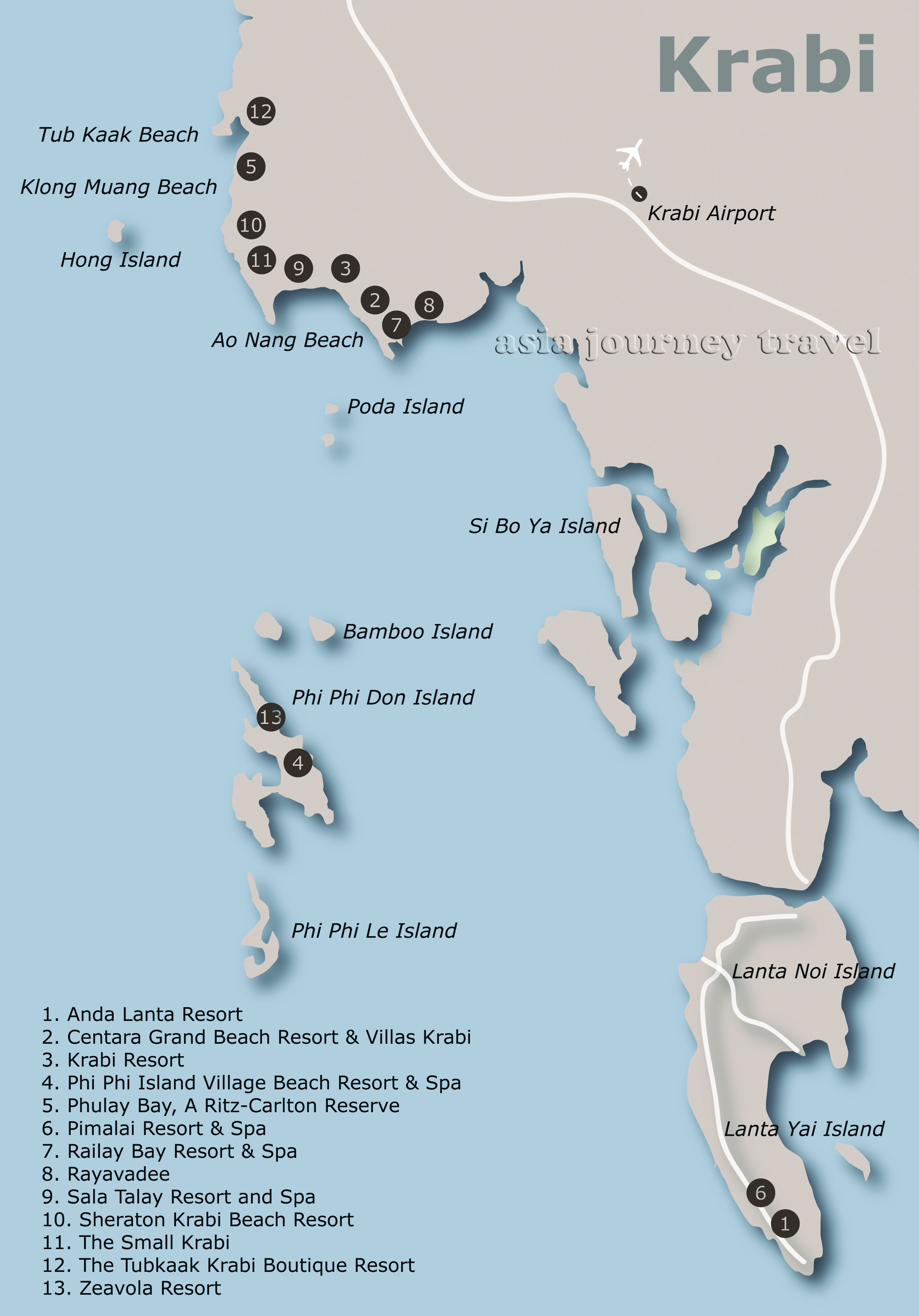
KRABI, KOH LANTA HOTELS

KRABI, KOH LANTA TOURS


KRABI

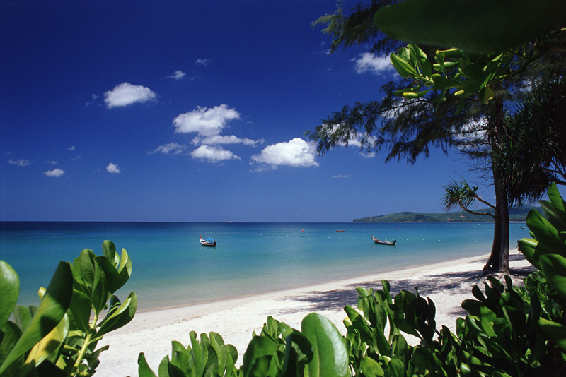
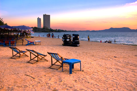
   Krabi Province is a popular beach destination at the Andaman Sea in Southern Thailand. Krabi, a coastal province, abounds with countless natural attractions that never fail to impress tourists. Such attractions include white sandy beaches, crystal clear water, fascinating coral reefs, caves and waterfalls, as well as numerous islands. The distinguishing feature of both Krabi and neighboring Phang Nga is the massive limestone karsts, rising vertiginously out of the flat rice paddies on land and as islands from the sea. Add in some gorgeous beaches and excellent scuba diving and rock climbing, and it's little wonder that tourism in the area has been booming. While less commercialized than neighboring Phuket, Krabi Province cannot be described as undiscovered: it receives two million visitors a year, and the major tourist areas cater extensively for foreigners. The best time to visit Krabi is between the months November to April when the area's climate is less hot than usual. During this period the island gets a lot of dry North Easterly winds, so giving dry blue skies and starry nights. Then, down on the beaches one can enjoy nice sea breezes. From June to November the area gets a lot of rainfall, more on average than the rest of the country. During this period the island gets a lot of moist South Westerly winds, so giving a mixture of dry days and wet ones. The sea stays at a warm 29°C all year round. Visitors however, coming in this period will find it cheaper.

KOH LANTA

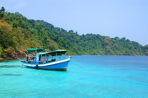
   Ko Lanta (เกาะลันตา) is an island off the Andaman Coast of Southern Thailand. Like many other destinations in Krabi Province, it is known for its diving and long white beaches. Ko Lanta consists of several islands, the two largest of which are Ko Lanta Noi (เกาะลันตาน้อย, "Small Lanta Island") and Ko Lanta Yai (เกาะลันตาใหญ่, "Big Lanta Island"). However, Ko Lanta Yai is where all the tourist action is, so this article will refer to it simply as "Ko Lanta". Ko Lanta is popular with tourists seeking a holiday away from the parties. It's popular with a significantly older crowd than nearby Ko Phi Phi: more walking on the beach and watching the sunset than drinking and dancing. However, there are plenty of bars and the longer term stayers are friendly and know how to party! It is also popular with families with young children, and of course, with divers. Ko Lanta can provide a party if you know where to look. Ko Lanta is a little less well-known than Ko Phi Phi, which has become more commercialised and corporate, but it is hardly undiscovered: the several beaches on the west coast of Ko Lanta Yai are each strung with a line of resorts and bungalows, although the farther down the island you venture, the less this is true. And even when the island is at it fullest, there will be a quiet place for you to relax - the beaches are never full. Ko Lanta is especially popular with Swedish tourists: although the "tourist language" is English as it is in most places in Thailand, and you will find menus and so on are translated into English, expect the poolside language to be Swedish much of the time. However, there are still many English and Irish bars and restaurants to visit.

KOH PHI-PHI

   Ko Phi Phi (หมู่เกาะพีพี) is a small archipelago in Krabi Province, Southern Thailand. The named islands are:

Ko Phi Phi Don, the largest and only populated island.

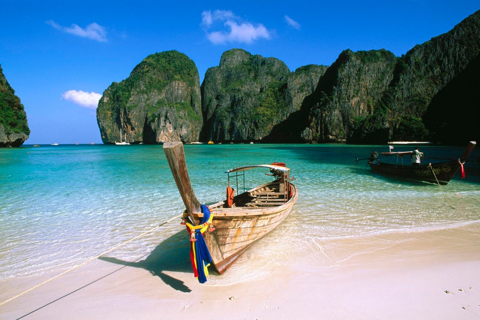
Ko Phi Phi Leh, a smaller island to the south, popularised when parts of the movie "The Beach" were filmed there. Uninhabited apart from bird nest harvesters and a few Maya Bay wardens; expect plenty of tourists during daylight hours, especially in Maya Bay, also known as 'the beach'.

Ko Mai Phai ('Bamboo Island'), a small low-lying islet to the north of Phi Phi Don with several good beaches.

Ko Yung (Yung Island) is north of Ko Phi Phi Don. The island has a stone beach in the east and small sandy beaches at the foot of the hills. It is teeming with various kinds of colourful coral reefs.

Bida Nok and Bida Nai, two small adjacent limestone karsts to the south of Phi Phi Leh, with near-vertical cliff walls rising from the sea. Most of the development of Phi Phi Don is situated in or around Ton Sai village, which is on the low, sandy isthmus that joins the two hilly spurs that comprise the rest of the island. There are also other, quieter resorts on Long Beach, Laem Thong, and at other less accessible areas of the island. Koh Phi Phi was devastated by the Indian Ocean tsunami of December 2004, when nearly all of the island's infrastructure was wiped out. Redevelopment has, however, been swift, and services are back with building regulations in place to limit the height of new buildings to preserve the island's stunning views. It should be noted that, while very laid back, many of the local islanders are Muslim. You will lose considerable respect if you walk around town in your skimpies (this applies to Buddhist areas of Thailand too!). While many tourists do in fact parade down Main Street in their Speedos or thong bikinis, to avoid offending your hosts, it's usually best just to throw on a pair of shorts or a sarong; similarly, topless on the beaches, while grudgingly tolerated by most locals, is also probably best avoided. Weather in the region is tropical - there are only two seasons: the hot season from January to April, and the rainy season from May to December. Temperatures during the year average 25ºC to 32ºC (77ºF to 89.6ºF) and the yearly rainfall averages 2568.5mm. Unlike in say Europe, the rain in this region comes down heavily over short periods.

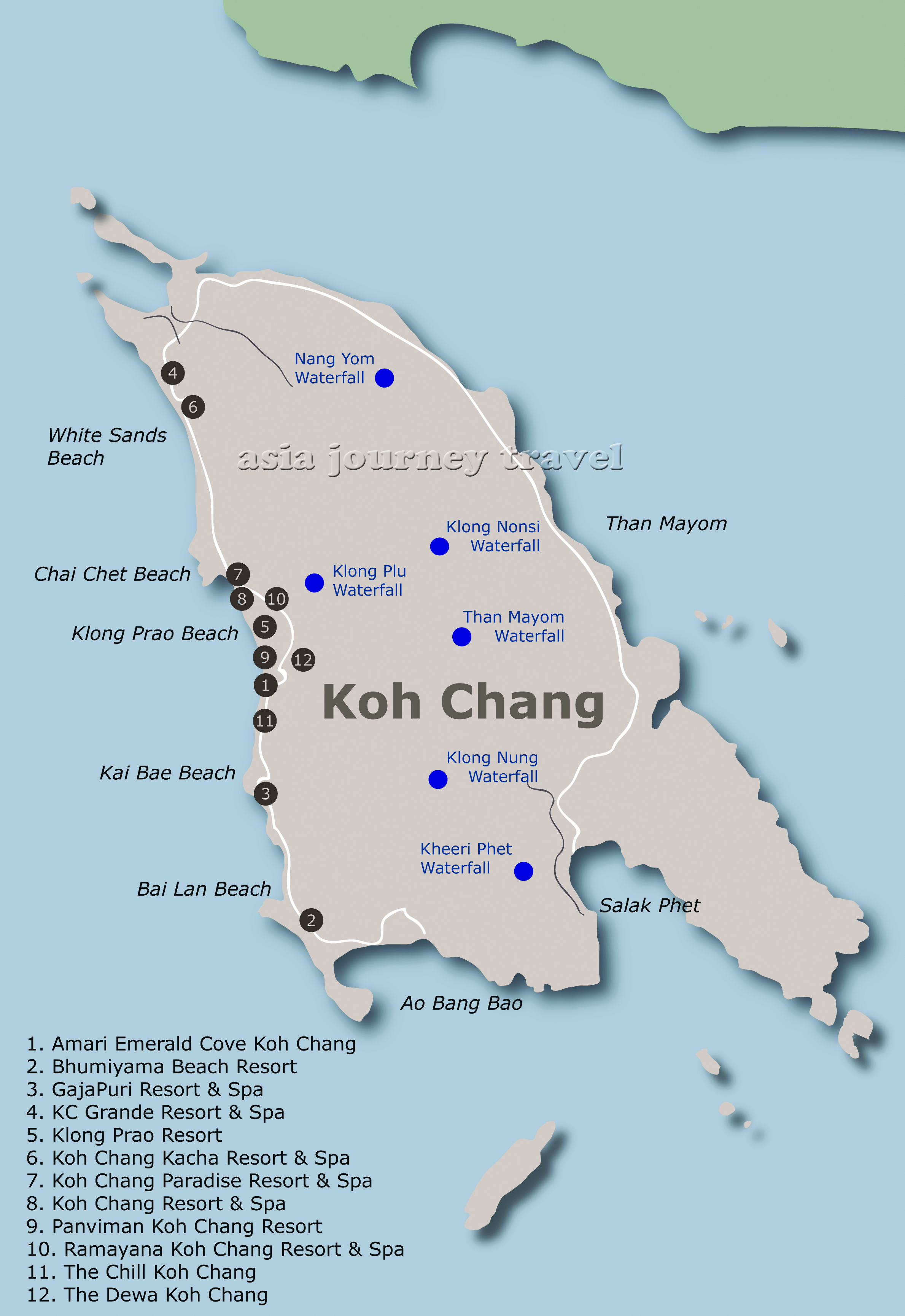
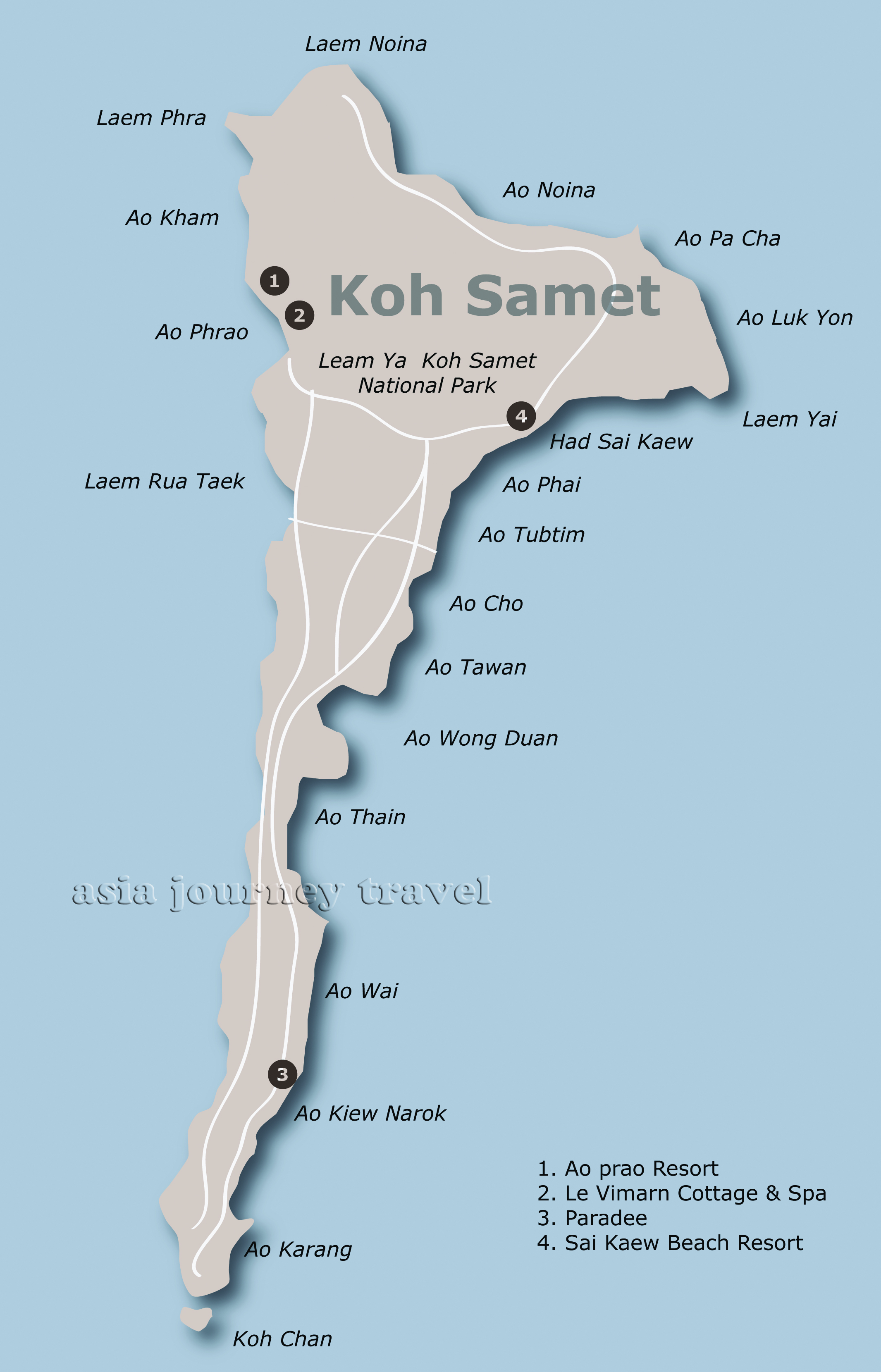
KRABI & KOH LANTA & KOH PHI-PHI MAP


Koh Chang

KOH CHANG HOTELS

KOH CHANG TOURS


   Ko Chang (เกาะช้าง) is an island in Trat Province, Eastern Thailand. Ko Chang is Thailand's second largest island, and the biggest in Eastern Thailand. With about 5,000 permanent residents the island is not heavily populated, but tourism (and development) has increased dramatically over the last few years. Ko Chang is one of Thailand's most beautiful islands with long white sandy beaches, most half deserted. The island is also home to a wide range of wildlife, including a good selection of birds, snakes, deer, and a number of elephants. The island and its vicinity are great places for snorkeling, diving and jungle hiking. The "discovery" of the island as a tourist destination since 2000 has brought on a large amount of rapid development, and while still far quieter than places like Phuket or Ko Samui, it's probably better to go now than later. Regarding services and activities specifically aimed at tourists prices have reached such a level that the islanders are pricing themselves out of the market when compared to the other islands.

History Prior to World War II, Ko Chang was little known by anyone. During this period, the few families there made a living growing coconuts and fruit on the mainland. In January 1941, during the Japanese occupation, the Thai Navy fought the French in a battle in the waters to the southeast of Ko Chang. Nothing else happened to Ko Chang until the first backpacker foreigners started arriving on the back of local fishing boats in the mid-1970s. In 1982, Ko Chang along with surrounding area became part of the protected Mu Ko Chang National Marine Park. Only very recently, in less than ten years, Ko Chang has turned itself into a major tourist destination, both for foreigners and local Thais. This sudden tourism boom however, has been fraught with controversy concerning land encroachment etc. The government is trying to "develop" it from a backpackers' paradise to a top-level destination, and construction work is going on throughout the island, with basic huts torn down to make way for fancy resorts.

KOH CHANG MAP


Rayong, Koh Samet

KOH SAMET HOTELS


   Ko Samet (เกาะเสม็ด), also spelled Koh Samed, is a small island in the Eastern Gulf Coast, within easy reach of Bangkok and Pattaya.

Just 200 kilometers from Bangkok in the Gulf of Thailand, the T-shaped island of Ko Samet is famed for its white sandy beaches, exotic coral and crystal clear waters. Ko Samet has developed steadily over the past decade or so, but it hasn't been the victim of over zealous construction which has hit the likes of Ko Samui (or even Ko Chang). The island is typified for its splendid beaches and white silky sand, surrounded by tropical coral reefs and crystal clear sea. Tourists can also enjoy a plethora of delicious cuisine and fine nightlife. It's a popular tourist destination for Thais and foreigners alike. As Ko Samet is so near Bangkok, the island is ideal for those in the capital wanting to chill-out with their families for a couple of days, without having to go through all that rigmarole of having to travel down south. It's only a 2.5 hour ride to Ban Phe, where one can take a 20-minutes ferry to the island. Even though Ko Samet is only a few kilometers from the mainland, the island with its micro-climate (the driest archipelago in Thailand) gets much less rainfall than the rest of Eastern Thailand. The rainy season is May to September but even then it still has significantly less rain than the other islands in Thailand. Tourists should, however, be careful of occasional storms. It is believed that once upon a time, Ko Samet was the home of pirates and that until this very day there is still lost treasures buried somewhere on the island. Thailand's legendary poet Sunthorn Phu was the first one to put this island on the map when he set his classical epic there, Phra Aphai Manee "The Story of Princes, Saga, Mermaids and Giants". Even though Bangkokians had known about the beauty of Ko Samet for decades before, the Thai government put this island off limits and restricted overnight stay there until 1981. In that year, on 1st October, the Forestry Department of Thailand declared Ko Samet and its surroundings to be a national park.

KOH SAMET MAP


Chiang Mai, Chiang Rai

CHIANG MAI HOTELS

CHIANG RAI HOTELS

CHIANG MAI, CHIANG RAI TOURS


Northern Thailand shares borders with Myanmar and Laos, as well as with the Central Plains and Isaan. Surrounded by the tallest mountains in Thailand, Northern Thailand is cooler than the rest of the usually sweltering country and thus particularly popular in December and January. In the mountains at night temperatures occasionally dip below freezing, although in the plains the daily average is rarely less than 25 Centigrade. Culturally, Northern Thailand shows heavy influences from the neighboring cultures of Myanmar and Yunnan (China). The kingdoms of Lanna (centered at Chiang Mai) and Sukhothai were the first historical Thai nations. Much of northern Thailand was for a long time off limits due to a series of Communist insurgencies and Myanmar's drug battles and civil wars spilling over the border. Both problems have been largely resolved, although caution is still advised near the border with Myanmar in the provinces of Tak and Mae Hong Son.

Chiang Mai - largest city in the north. Chiang Mai is situated at 300 meters above sea level in a large mountainous area. Located approximately 700km from Bangkok, Chiang Mai province is famed for its gloriously high mountain ranges, plentiful flora and fauna and crisp fresh weather. The province in Thailand is one of the country’s largest, covering 20,107 square kilometers. The actual meaning of Chiang Mai itself is “new city” and it was founded as the capital of the Lanna Kingdom in 1296 by King Meng Rai. Chiang Mai not only acts as the capital of the kingdom, the province was established as the religious center of the north and so innumerable temples have been built. The best time of the year to see Chiang Mai is from November to April where the weather is super-fresh and crispy and all the province's renowned flowers are out in full bloom. In fact, in the mountainous areas temperatures can dip down to freezing point. It doesn’t snow, but sleet is known to drop at times. One of the best times to visit Chiang Mai during this period is at Songkran (Thai New Year) as the town is synonymous with Songkran tradition, color and fun. During the hot season March to May temperatures especially in the city are high, going up to the high 30s. The rainy season in north is from June to October and trekking is not advised due to the chances of storms, winds and rains. From May to October there is a lot of rain but since the climate is tropical, the rain falls in quick heavy but short downpours.

Chiang Rai is Thailand’s northernmost province and a beauty it really is. It is situated on the Kok River basin well above sea level with an area of some 11,678 square kilometres. It is about 785km from Bangkok. Mostly mountainous, it reaches the Mae Khong River to the north and borders on both Myanmar and Laos. Popualtions have dwelled in Chiang Rai since the 7th century and it became the center of the Lanna Thai Kingdom during the 13th century. The region, rich in natural resources and textiles, was occupied by the Burmese until 1786. Chiang Rai province’s Golden Triangle bordering Laos and Burma was once the hub of opium production which had much influence on cultural practices and lifestyles. Until this day, entire clans live together in bamboo houses and each village has its own individual character. Chiang Saen, Mae Chan, and Doi Mae Salong are three substantially different places. Chiang Saen’s rich culture has been influenced by its collection of Buddhist scriptures and temples. It was once the provincial capital. Mae Chan’s name lies in its silver and tribal handicrafts. Once officially unrecognized by the Thai government, Doi Mae Salong is a Chinese KMT (Kuomintang) area renowned for its natural beauty and unique Yunnanese culture. Besides the Chinese 93rd Infantry of the Kuomintang, several other ethnic minorities have settled down in the region including the Tai Yai, Tai Lue, Tai Khoen and Tai Yuan.

NORTH OF THAILAND MAP


CHIANG MAI MAP


  1. Centara Duangtawan Hotel

  2. Dusit Island Resort Chiang Rai

  3. Four Seasons Resort Chiang Mai

  4. Four Seasons Tented Camp Chiang Rai

  5. Rati Lanna Riverside Spa Resort

  6. Tao Garden Health Spa & Resort


Asia Journey Exclusive Co., Ltd
919/535 (A), Jewelry Trade Center 47th Floor,
Silom Rd., Bangrak, Bangkok, Thailand 10500
Tel +66 2 630 3955; Fax +66 2 236 1823
E-mail russia@asiajourney-travel.com

09:00 - 18:00 working days,
10:00 - 15:00 Saturdays,
day off - Sunday.

Company Registration No: 0105556066701
TAT Travel Agent License No: 14/01461
ATTA Certificate No: 03481